Rocky Mountain Wolf Recovery Graph and Map
The following images are from the:
U.S. Fish and Wildlife Service, Nez Perce Tribe, National Park Service, Montana Fish, Wildlife & Parks, Blackfeet Nation, Confederated Salish and Kootenai Tribes, Idaho Fish and Game, and USDA Wildlife Services. 2010. Rocky Mountain Wolf Recovery 2009 Interagency Annual Report. C.A. Sime and E. E. Bangs, eds. USFWS, Ecological Services [here].
The 2009 NRM wolf population increased over 2008 levels and now includes at least 1,706 wolves in 242 packs and 115 breeding pairs. Wolf packs and especially breeding pairs largely remain within the core recovery areas, but for the first time breeding pairs were confirmed in eastern Washington and Oregon.
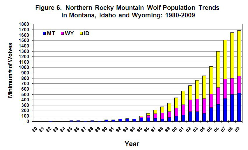
Rocky Mountain wolf population growth, 1980-2009, minimum estimate by state. Click for larger image.
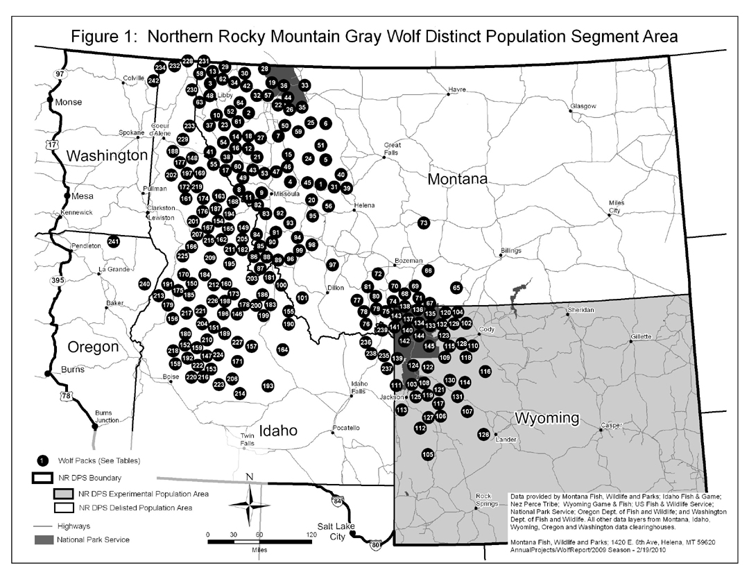
Map showing distribution of known wolf packs in the northern Rocky Mountain region. Click for larger image.
by YPmule
It’s a schematic map, and the packs are at best generally located on it. And, of course, the packs move around, sometimes hundreds of miles. So the map is symbolic only.
by YPmule
True, it is symbolic. The 2009 Idaho F&G wolf map shows towns and tries to show the pack territories.
http://fishandgame.idaho.gov/cms/wildlife/wolves/manage/09_map.pdf
I find it interesting that the map of Idaho only shows a few major cities outside of the wolf dots. It makes it appear that no one lives where the wolves are!